Breathtaking Views, Fabulous Estates, and Orchards!

Nestled between Montecito/Summerland and Carpinteria, California, Toro Canyon is associated with agriculture, great estates, recreation, and tourism.
Originally inhabited by the Chumash Indians, the area was later claimed by King Carlos of Spain and then granted to the Franciscan fathers when the Presidio and Mission were founded in Santa Barbara in 1782-86. The property was used as grazing land to support the needs of the Mission for livestock and food. When Mexico became independent from Spain in 1822, it secularized the missions and sold off the land in an attempt to break the Spanish hold in California. The Toro Canyon area was granted to the pueblo of Santa Barbara, which then granted the land to former Presidio soldiers in lieu of pay. In 1848, with the Treaty of Guadalupe Hidalgo, this former Mexican land became United States territory.
When California became a state in 1850, the land was given to the City of Santa Barbara, which sold it through patents. Numerous farmers from the East and Midwest moved to this area and bought small farms where they produced honey, hay, wheat, and barley. Commercial crops for which Carpinteria and the Toro Canyon area became well known were lima beans, walnuts, lemons, and avocados.

The land on either side of the Toro Canyon area was developed into the communities of
Summerland and Carpinteria in the mid-19th century. The first Americans to settle in Carpinteria came in the 1850s, and established the town by 1863 near Santa Monica Creek. Summerland was platted in 1888 by H. L. Williams on a 160-acre parcel of the old Ortega Rancho. Additionally, the small town of Serena was platted below Nidever Road. Between these two small communities lay the Toro Canyon area with its small farms. The name apparently was given to the area because the canyon provided a natural corral where bulls were confined.
Today, the Toro Canyon area is a mixture of citrus and avocado groves, industrial parks,
residential developments, large nurseries, and horse ranches. Its agricultural heritage is still very much in evidence, in spite of the suburban development along Highway 101. The acreage along Via Real from Nidever Road to Cravens Lane is covered with greenhouses and growing fields for such companies as Gallup & Stribling Orchids and Colorama. The land east of the Polo Fields is also the site of a number of greenhouses.
Toro Canyon is bordered by the Summerland and Montecito Community Plan areas to the west, the Pacific Ocean to the south, the Los Padres National Forest to the north, and Rancho Monte Allegre and Carpinteria City limits to the east. The southern portion of Toro Canyon lies within the Coastal Zone.

Map of Toro Canyon
Toro Canyon’s 5,750 acres1 support large areas of agriculture (including greenhouses), low density residential, some commercial and recreational areas, and undeveloped open space. The Plan Area includes approximately 1,000 parcels and the following land uses: 850 residential units; 61,665 sq. ft. of commercial and industrial space; 5,236,132 sq. ft. of greenhouses and related development; 88,545 sq. ft. of institutional/educational development; and 130,399 sq. ft. of other non-residential development. Major access roads into Toro Canyon include U.S. Highway 101, Via Real and State Route 192 (East Valley Road/Foothill Road).
Residential development is scattered throughout Toro Canyon, generally with larger parcels to the north and smaller parcels to the south. Santa Claus Lane and Via Real at the eastern Padaro Lane/Highway 101 interchange are the only commercial areas in Toro Canyon.

Toro Canyon supports a high diversity of biological resources, including southern oak riparian woodland, coastal scrub and chaparral. The watersheds of both Toro Creek and Arroyo Paredon Creek support stretches of relatively undisturbed habitat serving as wildlife corridors between the mountainous Los Padres National Forest and the Pacific Ocean.
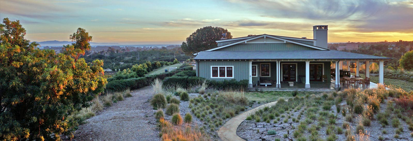
Residential development began in Toro Canyon in the 1920s with subdivision of several small farms. Today, about 850 residential units are scattered throughout the Plan area, with 113 of these units located on agriculturally zoned land. Roughly 1,450 acres are designated for residential uses, with minimum lot sizes ranging from 8,000 square feet to ten acres. Generally speaking, parcel size increases from south to north. Several neighborhoods with parcel sizes between 7,000 square feet to one acre exist in southern Toro Canyon, including beach front properties along Padaro Lane and Rural Neighborhoods (RNs) surrounded by agricultural and rural land. Upper Toro Canyon (generally north of East Valley Road and Paredon Ridge) residential development is characterized by parcel sizes of five acres or greater, and is generally associated with either agricultural uses or large estates. With the exception of the Serena Park and Ocean Oaks Road neighborhoods, most of the dwellings in Toro Canyon are large, singlefamily estate homes. This trend of large single family residential development has continued in recent years.

Upper Toro Canyon, the subarea with the greatest constraints, contains the greatest number of parcels with the potential for future development. Building trends involve new custom homes with structures far larger than existing homes, from 5,000 to as large as 20,000 square feet.
The following is a brief description of the existing residential patterns, types of neighborhoods and zoning districts in Toro Canyon from south to north.
Beach Front Residential
The Padaro Lane residential area is a Rural Neighborhood located south of U.S. 101, adjacent to the Pacific Ocean. This area was developed in 1920 as the Town of Serena and was laid out in long narrow lots oriented perpendicular to Padaro Lane, formerly the Coast Highway, to the ocean. Today, the area is a mix of primary and secondary residences. The lots are generally larger at the western end of Padaro Lane, becoming narrower with smaller lots toward the eastern end. Directly east of the larger western properties is the “Beach Club Road” tract, a 1950s housing development with smaller parcels.

Serena Park
This Rural Neighborhood is located at the northeast corner of Via Real and Toro Canyon Road and first resulted from a 34-acre farm subdivision in the 1920s laid out along Oak Avenue, Ocean View Avenue, and Serena Avenue. Most of the lots are less than one acre, with several larger parcels toward the northern end of the subdivision. Zoning designations include 1-E-1 in the northern portion, 12-R-1 in the eastern portion and 20-R-1 elsewhere.

Las Canchas Condominiums (Polo Club area) This complex of 140 units is located to the west of Nidever Road between Via Real and Foothill Road, amid the Santa Barbara Polo and Racquet Club. It was approved in the early 1970s in connection with the Polo Club. The polo fields and other related open space were counted toward the overall density of the project under DR-2.5 zoning (ref. Ord. 2243, Tract 11,620 & 71-CP-46), with most development rights for the fields and open space being granted to the
county under the terms of Ord. 2243 and 71-CP-46. As such, since the time that the LCP was originally adopted and certified in the early 1980s, the site’s zoning has been split, with DR-2.5 for the condominium area and REC for the Polo Club grounds. The condominium complex is considered to be a conforming use under the terms of its original adopting ordinance/ development plan.
La Mirada/La Paquita
This Rural Neighborhood is located north of Foothill Road, approximately 2,500 feet east of Nidever Road. The lots are generally less than one acre, with a few larger lots (three to six acres) in the north, which coincide with the 1-E-1 and 5-E-1 zoning designations of this area.
Ocean Oaks Road
This Rural Neighborhood is located north of Foothill Road, approximately 5,000 feet east of Nidever Road. Most of the lots along Ocean Oaks Road are approximately 25,000 square feet. A few larger lots to the west are one to two acres. This conforms to the zoning designations, which are 1-E-1 to the west and 20-R-1 along Ocean Oaks Road.
Torito Road and Vicinity
This Rural Neighborhood is located along Toro Canyon Road between Foothill and East Valley Roads. Most of the area is characterized by lots of one to two-plus acres, with zoning of 1-E-1.

Residential Estates
Residential estates are concentrated in Upper Toro Canyon, generally with larger parcels to the north (along Toro Canyon Road and east of Ladera Lane) and smaller parcels to the south (south of East Valley Road). Some large estates also occur in the more level topography of the mountainous and the coastal areas. Large single family custom homes are predominant on residential estate lots, sometimes with second units or guest houses. Residential estate lot sizes vary from one to twenty acres and are located in a wide range of zoning districts, including 1-E-1, 5-E-1, 10-E-1, RR-5, RR-10, and RR-20. However, parcel sizes do not always equate to the respective zoning district minimum parcel size requirement.
Rural Residential
Most of northern Toro Canyon is rural with diverse residential development, sometimes associated with agriculture. Steep slopes prevent dense residential development. The parcel sizes generally range from 20 to 160 acres, typical of the agricultural, residential ranchette, and large estate land use designations of the area.

